

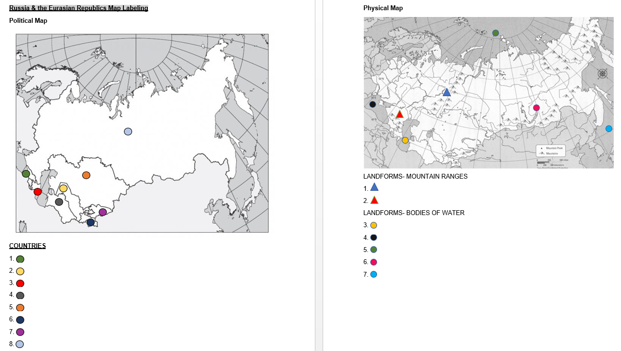
As a middle school geography teacher, getting students to label maps is not the easiest task. They get bored, say it’s too difficult, and try to rush through it. With distance learning, the task has only gotten more difficult. Without the option of tangible map labeling, I created alternative map labeling documents that can be used on electronic devices and platforms. Then, I realized the shapes and colors I used were getting confusing for my students so, I changed it to numbered icons. These yield a greater success for students and are better for students with color blindness. See the comparison here:
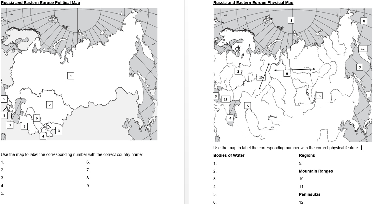
This resource of Eastern Hemisphere maps breaks the hemisphere into regions typically taught in a middle level geography class. These maps are already scaffolded as they’re broken into categories. You can find a set of these Eastern Hemisphere map activities (using numbers as labels) in my Teachers Pay Teachers store by clicking on the link below:
-CC
